Tuesday, October 15, 2013

Alaska Trip 2013 Testa River Campground - Home

Day 25, July 5th we left the Testa River Campground and headed to Fort Nelson. When we got there, I filled the Roadtrek up at the Husky Station on the north end of town. Then I went down to the IGA store. I noticed that they had fresh baked goods so I got a couple of bear claws, one for right then and one for later. Later that day we reached Fort St John and stopped at the Safeway. I got a few groceries and then went to the Starbucks that is inside the Safeway and got a cup of coffee and used their wifi. Being back in Fort St John meant that my cell phones worked again. I called everyone to let them know we were OK and were back in the part of the world with cell phone coverage. We drove on to Grande Prairie AB and spent the night in the Walmart parking lot.

Day 26, July 6th we headed out from Grande Prairie toward Edmonton. When we got to Whitecourt, we filled up with gas and I emptied the black water and gray water tanks at a public dump site.  Later in the day, when we got to Stony Plains AB, which is just before you get to Edmonton, we stopped at a Safeway and used their wifi. By the end of the day we were in North Battleford SK. We stopped at the North Battleford Walmart and spent the night in their parking lot.

Day 27, July 7th we left North Battleford and made our way to Saskatoon. I went to a local Safeway and got some bananas and oatmeal raisin cookies for breakfast. Then we drove down through the middle of town and picked up the Yellowhead Highway and headed southeast. As I was driving along, I got to thinking about a  video that I had seen on Youtube about a town called Cymric SK. I love country stores and that was about all that remained of Cymric. The outside of the store reminded me of several I had known as a boy in rural Alabama. I checked and it would only add about 30 miles to our trip. When you are making a eleven thousand mile trip, 30 miles seems fairly insignificant so I turned off the Yellowhead and went down to Cymric. It was Sunday so I was not sure that the store would be open but I figured that at least I would get to see the outside in real life instead of a video. When I got there and pulled up in front, I noticed that the light bulb hanging down in front of the front door was on. I walked up to the door turned the knob and walked in. I looked around and it was just what I expected. It could have just as easily been 1955 and in Richville, Equality or Pentonville AL. After a minute or two a lady came out of the back. I got a Snickers bar and a Pepsi and went to the counter to pay. I told her where I was from and what had me in Cymric SK on a Sunday Morning. She was very friendly. She explained how the store had once sat in the townsite of Cymric over next to the railroad tracks but that the man that owned it was leasing the land that it sat on. The land the store was sitting on in the town was owned by another gentleman who also owned a store in town. When the lease came up for renewal the property owner declined to renew it so the store owner moved the store building to some land he owned at the intersection of Hwy 20 and the grid road. Over the years the town gradually disappeared until now only the little store remains. The lady said that the original owner had sold the store to a couple who ran it for several years and then sold it to this lady and her husband. I believe she told me that she and her husband had run the store for 26 years. Among the items for sale in the store were tee shirts with pictures of the store on them. I got me a green one. Before I left, I walked across the road and got a picture of the Roadtrek sitting in front of the little store in Cymric.

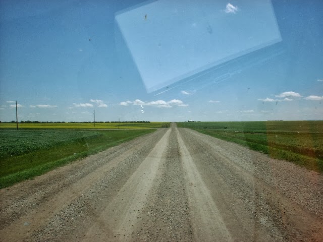
We left Cymric and made our way down to Lumsden. From there we took SK Hwy 641 down to Rouleau. Hwy 641 is a gravel road.

It had been rainy and messy in Rouleau on my way up, but July 7th was a beautiful day so I decided to stop and go in and check out the Corner Gas set. I found out from the young lady that was running the gift shop that this was the second summer it had been opened. They sell different Corner Gas souvenirs. I bought a complete box set of the episodes on DVD and a souvenir car tag.

We left Rouleau and made our way down to Portal ND. We made the border crossing without problems and continued on to Minot ND were we gassed up and got some things for supper. July days in North Dakota are long so we kept on driving until we got to the Apple Creek Rest Area on I-90 east of Bismarck. We parked there for the night.

The next day was day 28, July 8th. We got up and got everything settled to travel. I checked the oil, water and tires and got back in the Roadtrek and went to start it and nothing happened. Immediately I thought something had failed and had run our vehicle battery down over night. I still had the house battery, the generator and a emergency jumper that I had bought and brought along on the trip for just such a situation, but before I broke out all of that I decided to check under the hood again. Upon close examination, I discovered that the wing nut on the battery cut-out switch had loosened. I tightened it up and got back in and turned the key. The Roadtrek started right up. Emergency averted.

We retraced out route back down through North Dakota and South Dakota. When we got back to the site of Bangor SD we stopped. I took another picture of the memorial. Notice how much the corn in the field had grown since our previous picture.

We drove nearly 600 miles on July 8th and by the end of the day, we had gotten back to Pony Creek Campground near Pacific Junction IA where we again spent the night.

Day 29, July 9th we left Pony Creek and headed toward Kansas City, when we got to Kansas City we departed from our original route and took I-70 toward St. Louis. On the way we past near Columbia MO so I got off I- 70 and drove down through the University of Missouri campus.


The University of Missouri campus reminded me a bit of the University of Alabama campus in Tuscaloosa.

In St. Louis we picked up I-55 south and made our way down to the Hawn State Park where we spent the night.

July 10th, was day 30 and the last of our trip. We followed I-55 down to I-155 and crossed the Mississippi River on the I-155 bridge to Dyersburg TN.


From Dyersburg we went down through Jackson TN to Tupelo MS and picked up I-22 again and followed it home  to Birmingham and  then on to Pelham. We had been gone for 30 days, travelled 11,001 miles and burned 772.995 gallons of gasoline. It was a great trip and as they used to say in the Rockford Chronicle, "A good time was had by all."

Monday, October 14, 2013

Alaska Trip 2013 Tolsona - Anchorage - Lakeview Campground - Testa River Campground

July 1st, day 22, we left Tolsona and headed west on the Glenn Highway toward Anchorage. Along the way we stopped for Regan to get some pictures of the Matanuska Glacier. When we got to Anchorage, we spent the rest of the day checking out various sites. Previously I had read some unfavorable reviews of the RV parks in the city of Anchorage and had avoided them but Regan and Gantt had an early morning flight so it was important that we be near the airport. While we were at Tolsona I used the excellent wifi to do a more comprehensive search and decided that the Gold Nugget RV Park was probably our best bet. We ate supper at the  Qdoba Mexican Grill on North Muldoon and then made our way to the Gold Nugget for the night. I can't speak for those other RVers that had posted low ratings for Gold Nugget but I found it to be fine.

We got up early on July 2nd, day 23 and took Regan and Gantt to the airport for their flight home. Then Dixie and I headed the Roadtrek east. Originally I had intended to stay a bit longer this trip but things had changed at home while we were gone. Linda's doctor had decided that she was going to have to have surgery. At the time we left Anchorage, he had not set a date and she was worried that it would be before we got back. We stopped in Palmer, the home of the Alaska State Fair, and filled up with gas and got breakfast at McDonalds. Then we pushed on to Glennallen and another fuel stop. We were not that low on fuel but it was my intent to top off in each town as we got closer to the Canadian border. I did this topping off  instead of waiting until the last minute before crossing the border and being confronted with a station that was closed. Mid afternoon we made it to Tok. I went in the Three bears and got some things we would need on our trip home and we topped of the gas tank at the Shell station. Later that afternoon we stopped for the night at the Lakeview Campground in the Tetlin National Forest near the Canadian border. I snapped a couple of pictures of our campsite and the nearby lake but apparently there was a camera malfunction and only one of them took.


On my trip in 2008, I had laptop problems. This time I took a laptop and a tablet and did not have any computer problems but my camera malfunctioned. If I had realized it was not working I could have taken pictures with the tablet or with one of my phones, but I did not check the pictures until I got home.

After a peaceful night in Lakeview (Dixie and I were the only ones there) we woke up on July 3rd, day 24 and headed for the border. This is the sign at the foot of the hill after you pass US Customs, as I said before Canadian Customs is 32 km further down the road.

We passed through Canadian Customs with no problems and continued our homeward trip. Mid afternoon found us in Whitehorse. Regan had given me the names of two restaurants that her guide book recommended in Whitehorse. I went to one of them and had a smoked salmon wrap with fries and a coke. It was an excellent late lunch. I had used most of my Canadian cash on the trip up and as there were several banks within walking distance I decided that now would be a good time to get some cash  from an ATM. On my trip in 2008 I had used Canadian ATMs on 2 or 3 occasions without problems. Since my experience with American credit cards and gas stations, I was a bit concerned about this time. In Canada the ATM machines seem to all be in a lobby inside the front doors of the bank but before you enter through another set of doors into the main area of the bank. I suspect it has something to do with the winter weather. I doubt that anyone would want to stand outside at - 40 degrees F or C to get money out of an ATM. Anyway, when I walked through the front doors of the bank there were 3 ATM machines sitting on the left wall. The one in the middle had an out of order sign on it. The other two had lines of people running all the way back to the other wall. I got into one of the lines. I quickly discovered that in addition to people waiting to do ATM transactions, there were bank employees standing there as well. Gradually I figured out that most of these people had received new ATM cards with chips in them and they were going through the process of activating them. The bank employees were there to assist them. A guy in the line next to me walked up to the machine on the right and a bank employee walked up with him. The bank employee turned and faced away from the ATM and told the guy to put his card in the ATM. Then he proceeded to talk the guy through the process that involved several steps which I remember included the guy entering his PIN several times. Finally the process was complete and someone else took their turn. When it came my time I was apprehensive. I knew my card did not have a chip. I put it in the slot as I would anywhere in the US, it asked me my PIN, I entered it, it asked me  what I wanted to do, I entered that, it gave me my $CDN and I was on my way, very relieved. Later that day we made it to Squango Lake Campground and pulled in for the night.

The next day was July 4th, day 25 of our trip. I woke up, cleaned up, did our preflight (checked tires, water and oil on the Roadtrek) and took Dixie for a walk, not necessarily in that order. I had mentioned to someone during a phone conversation about the sign on the water pump at Squango Lake. I decided I would take a picture to prove that I wasn't kidding.


The first picture was taken so both the pump and sign were in the picture, the second was taken in case the sign in the first one was not readable. As it turns out, neither of them were readable. It was early in the morning and I believe that the low light caused the flash to go off. The sign apparently is reflecting the flash. Anyway, if you could read it, the sign would tell you that the water from the pump is not to be used for cooking or drinking without being first boiled for 10 minutes.

I also took a picture of the Roadtrek sitting in our camping space. It turned out better than the pump/sign pictures.

Around noon, we got to Watson Lake YT. Watson Lake is on the north edge of that stretch of wilderness that the Alaska Highway runs through north of Fort Nelson, BC. Making a fuel stop is a must on the way up and on the way back. On the way up I had stopped at the Watson Lake Motors, the pumps were convenient to get to, the price was not bad (for YT anyway) at $1.449 per liter and the guy inside was friendly. I decided it would be an appropriate place to stop on the way back. I had to wait in line for a few minutes because there were a couple of vehicles in front of me. Finally it was my turn, I pulled up to the pump and put in 70.12 liters, $101.60 CDN. When I finished pumping my fuel I pulled the Roadtrek up to clear the pumps and went inside to pay. There were 2 other people standing there and the guy who ran the place was on the phone. The lady standing nearest the counter said, I burned up his machine. Turns out that when he swiped her card, sparks flew out of his card reader. It was toast. After a few minutes the owner got off the phone and said that the company that he rented the reader from was sending him out a replacement. It would arrive by bus in 2 or 3 days. We had two options: (1) give him our card numbers and he would run our transaction when the new card reader came in or (2) if we preferred, pay with cash. Since I had been to the ATM the day before in Whitehorse, I had about $120 CDN so I opted to just pay him with cash. I think that he would have taken US currency as well, but to make it simple I just paid with my CDN $. There was a third guy standing over in the corner, a local not a customer. He said that there was a bank next door with an ATM machine so when I finished paying for my gas I drove over there and replaced the money I had just spent.

Just down the street from the Watson Lake Motors and the bank, there is a grocery store. I have stopped there before because it is handy and it has a payphone out in the front. Remember this is between Tok, AK and Fort St John BC so no cell phone coverage. I drove down to the grocery store and parked out on the side of the service road. Just inside the first set of doors is the payphone. I made the calls to everyone and let them know that we were OK. When I was talking to Regan she mentioned that they were about to eat. She said she supposed that I would not be getting a traditional July 4th meal up there in Canada. I acknowledged that I suspected that was the case but that every time the second set of doors behind me opened into the store, I was catching the aroma of something that smelled good. I told her that when I got off the phone I was going in and get some lunch. Just inside of the second set of doors on the left was the deli section. When I walked over to the counter the first thing I saw was several racks of BBQ spare ribs. In the cooler just around the corner they had homemade potato salad. I already had bread and potato chips in the truck. Needless to say, I got a rack of the ribs and a container of the potato salad and Dixie and I had a very traditional July 4th lunch sitting right there on the side of a service road in Watson Lake YT.

In Alaska and Canada, moose, bison, and sheep don't pay a road or vehicles any attention. They will walk right out in front of you, or if you come upon them standing in the road you may have to wait awhile for them to move out of the way. This is not the case with bears. When you see them out in the  open, they are usually on the move. Because of this, bear pictures are hard to come by. I was a few miles south of Watson Lake when I say one crossing the road in front of me.


Don't see him? Click on the pictures to blow it up and then look for a little black speck in the middle of the road up where it curves around that little hill. By the time I got up to where he had crossed the road, he was down in the ditch. All you could see was his back and behind.


About 2 hours south of Watson Lake just south of Fireside, we came upon another herd of bison. I say another herd because I am under the impression that there are multiple herds and this one was about 50 miles north of where we had seen the previous herd on our way up. Also this one seemed to be a lot bigger.


There were sheep in the road near km 740

And some more down around km 600 near Summit Lake


At the end of the day we found ourselves near the Testa River Campground. I had not stayed there before but decided to give it a try. It was very nice, located  right beside the Testa River. The camp hosts were exceptionally friendly. So were the mosquitoes. I really enjoyed talking to the camp hosts and avoided the mosquitoes as much as possible.


Sunday, October 13, 2013

Alaska Trip 2013 Tolsona - Kenai Peninsula - Fairbanks - Tolsona

On day 12, June 21th, we left Tolsona Wilderness Campground and drove the 165  miles to Anchorage. When I originally planned this trip I estimated that it would take us about 15 days to drive the 4500 miles from Pelham to Anchorage. That schedule would have put us in Anchorage on June 24th. Regan and Gantt were scheduled to fly into Anchorage late in the day on the 25th. However we had made much better time than I had originally figured so here we were in Anchorage four days early. We spent a few hours in Anchorage and then headed down the Seward Highway to the Bertha Creek Campground. Linda and I had stayed there in 2008. It is small, only about a dozen spaces but it is a wonderful campground. When we got there I checked to see if space 6 was available and it was. We parked the Roadtrek and Dixie and I walked up to the entrance and registered. I like space 6 because it comes with its own waterfall.

The next day, June 22th day 13 we left Bertha Creek and went down the Seward Highway to Seward. They say that Seward is where the cruise ships dock, but I have never seen one there. It is the southern terminus of the Alaska Railroad. There was a train going south at the same time we were and we got to Seward at about the same time. We wandered around Seward for a while, ate lunch at a food truck (actually I think it was a trailer instead of a truck) and found another car wash and made another try at cleaning up the Roadtrek. White trucks and dirt roads don't do too well together. After I finished washing the truck, we went back up the Seward Highway north of town and turned and went out to see the Exit Glacier.


I had intended to spend another night at Bertha Creek but when we got back up there that afternoon, it was full so we went back down the Seward Highway to the Sterling Highway and went over to Kenai. We spent the night in Kenai and spent the next two days June 23rd and 24th, day 14 and day 15 exploring the western part of the Kenai peninsula. We drove down to Homer, Up to the Captain Cook Recreation Area and out Funny River Road south of the Kenai River in Soldotna. At the end of the day on the 24th we found ourselves back at our favorite campground, Bertha Creek.

Next day, June 25th, day 16, we left Bertha Creek and went up the Seward Highway to Anchorage. Remember I said that I left my bed roll at home. I had been using the spare linens that I originally intended for  Regan and Gantt. They  were due in later that day so I went shopping for additional sheets, pillow cases, etc. After that we went to a Lowes and got a longer handle for the squeege that I had bought in Lloydminster. For lunch we located a deli down close to 100th ave and Old Seward Highway and had a great tuna salad sandwich.

Later that afternoon we went over to the Ted Stevens International Airport and waited in the cell phone parking lot for Regan and Gantt's flight to arrive. The cell phone parking lot is right next to Lake Hood. Lake Hood is where the float planes land and take off and it seems like about every minute there is either one taking off or landing. If you look behind the light pole in this picture you will see one of the float planes just lifting off.


Later on when Regan and Gantt's flight arrived, I picked them up and we went to get supper and then headed back down to Bertha Creek. When we got there, space 6 was occupied but we were able to find a space, just not one with its own waterfall.

Next morning June 26th, day 17 we headed down the Seward Highway to the Sterling Highway and took it over to Cooper Landing. One of the things that Regan and Gantt had hoped to see was a salmon run. A guy that was camping at Bertha Creek had told me earlier in the week that they were beginning to run at Cooper Landing. We saw a few fishermen but no true combat fishing. I think we were a bit early. Mid July would have probably been a better time.

We left Cooper Landing and made our way back out the Sterling Highway to the Seward Highway. We spent the rest of the day in Seward and camped that night at Miller's Landing south of Seward. I did not take many pictures while Gantt and Regan were there because Regan was able to do a much better job and I was driving, but I did get this one while we were camped at Miller's Landing of Gantt and Dixie watching TV in the back of the Roadtrek.


Next morning June 27th, day 18 we went up to Seward and ate breakfast and then went to the Alaska Sealife Center. It was a great place, full of lots of interesting aquatic exhibits. The highlight was when they fed one of the sea lions.


We left the Sealife Center and made our way to the local Safeway to buy some groceries and use their wifi. After we left Safeway we went up the highway and drove out to the Exit Glacier. The three of us walked out to an observation point that was much closer than I had been when I went earlier. When we left the Exit Glacier, we went back out to the Seward Highway, then up it to the Sterling Highway and turned and went over to Soldotna. We spent the rest of the day in Soldotna and Kenai seeing the sites. We went out Funny River Road and Regan and Gantt had their first moose sighting.

Next day June 28th, day 19, I took Gantt and Regan over to Whittier so they could take the 26 glacier cruise. I think they enjoyed it, but before they came up, I had told Regan that it was unseasonably warm in Alaska and she had packed accordingly. Consequently she did not have any really warm clothes with her and  I think she nearly froze on the cruise which lasts about half a day. I stayed in the Roadtrek and rested while they were out on the glacier cruise but I did snap a couple of pictures from where we were parked.


Whittier is down on the water with mountains surrounding it. They say that there is a period of time in the winter that direct sunlight does not hit it, the light reflected off the mountains is all they get. Judging from the two times that I have been there, they don't get a heck of lot of sun the rest of the year either. After we left Whittier we made our way back up through Anchorage and spent the night at the Big Lake Recreation Area located near Houston.

Next morning, June 29th, day 20, we went up the Parks Highway to Talkeetna and had breakfast at the Talkeetna Road House and then walked around the little town of Talkeetna. Some folks claim that the fictitious town of Cicely AK in the TV program Northern Exposure was based on Talkeetna. After we left Talkeetna we got back on the Parks Hwy and made our way up toward Fairbanks. The Parks Highway has several places where on a clear day you can see Mt McKinley in Denali. This time the mountain was obscured by clouds just like it was in 2008. It took us quite awhile to get to Fairbanks. Part of that is due to the fact that it is 330 miles from Anchorage but we also had construction delays to deal with and when we got close in, they had pilot cars leading us through an area that was having problems with smoke from the forest fires to the north limiting visibility. When we got to Fairbanks we went to the Rivers Edge RV Park and hooked up the electricity and turned on the air conditioner. It was hot.

June 30th, day 21 we left Fairbanks and drove down to North Pole to the Santa Claus house. Did not see Saint Nick this time but we did see some reindeer and got some presents for the peeps who had to stay home and did not get to make the trip. Gantt and I flattened some pennies in the elongated penny machines. We left North Pole and made our way down the Richardson Highway stopping at Rika's Roadhouse for lunch and stopping at several sites to view the Alyeska pipeline. Late in the day we found ourselves near Glennallen so we made our way over to the  Tolsona Wilderness Campground and spent the night.


Saturday, October 12, 2013

Alaska Trip 2013 Squango Lake YT - Tolsona Wilderness Campground AK

We left Squango Lake campground on day 10, June 19th and headed toward Whitehorse YT. Whitehorse is a fairly good sized city with lots of gas stations, restaurants, fast food places, grocery stores, etc. We bought gas and went to Walmart and picked up some 4 liter jugs of drinking water and a few other items. Since we had no cell phone coverage, I began to look around for a pay phone so I could use my keepcalling.com calling card to check in and let everyone know we were ok. I finally located one in a small park down on the south side of town near the river. After I finished making my calls I was walking back to the Roadtrek and there were three or four ladies with a couple of little children in tow walking in the same direction. I heard one of them say, I haven't ridden the trolley since I was a kid. When I got to the Roadtrek I noticed they were walking on up the hill next to the parking lot. As I drove off, I looked and sure enough, there was a trolley.

When I got home I looked the Whitehorse trolley up on the internet. It is real interesting. Next time I am in Whitehorse I may try and take time and ride it. When we finished up in Whitehorse, we went up Two Mile Hill Road and rejoined the Alaska Highway.

A little ways above Whitehorse you can turn left and follow the route of the original Alaska Highway from mm 929 to mm 934. In 2008 I had driven a few hundred yards out on to the northern end of the old highway but this time I decided to drive the entire 5 miles.


Further north the Alaska Highway runs along the side of Kulane Lake for several miles. The water in Kulane Lake is a beautiful shade of turquoise.


We ended the day at Lake Creek Campground which is about 111 km southeast of the Alaska Border.

We got up on day 11, June 20th and continued our journey north. We had only driven about 10 km and were getting close to Pickhandle Lake rest area when I noticed a bull moose on the side of the road. It is not completely evident from the pictures, but the moose was eating the leaves out of the top of that tree that he was walking around.


We left our second close encounter with a moose and drove on to Beaver Creek YT. Canadian customs is located just north of Beaver Creek but the actual border and US Customs is located about 32 km north of there. That has got to be about the worst 32 km of road I've seen. This time nearly the whole length of it was under repair. At times the traffic was routed off to the side since the entire roadbed was being dug up and regraded. The construction zone was so long that the pilot car we were following from the south end handed us off midway to another pilot car that took us on to the end of the reconstruction near the border.

We crossed the border over into Alaska with no problems and continued on north. As I mentioned previously, when you get near Tok, cell coverage kicks back in. When we got to Tok, I went into the Three Bears and got some things for lunch and something to cook for supper. Then we hung around town for awhile so I could call our peeps and let them know we were OK. Finally, we headed down the Tok Cutoff toward Anchorage. The Tok Cutoff runs from Tok to the Richardson Highway a bit north of GlennAllen. You follow the Richardson down to GlennAllen and then pickup the Glenn Highway to Anchorage. When we got to GlennAllen we had already driven about 300 miles. Although most days we drove more than that, 300 was kind of our unofficial daily target. On my last trip, I had stayed at the Tolsona Wilderness Campground which is not to far west of GlennAllen. It is a nice place so we decided to stop there for the night. I had picked us up some ground beef at the Three Bears in Tok, so I fixed Dixie and myself hamburgers for supper. Then I took advantage of Tolsona's excellent washers and dryers to do a load of clothes. Tolsona may be out in the middle of nowhere but have great wifi so I was able to check up on my emails. We went to bed that night relaxed and content.

Friday, October 11, 2013

Alaska Trip 2013 Vegreville AB - Squango Lake YT

As I said in my previous post, it was overcast and rainy the morning of day 7, June 16th. I had hoped the night before when I went to bed that it would rain out during the night. We had been able to continue on the previous day without wipers because it was not raining hard but I was afraid that if it started raining hard we would have to stop and wait it out. When we left Vegreville it was not raining but was very overcast. By the time we got to Edmonton, which is about 100 km west of Vegreville, the sky had cleared considerably. We stopped in Edmonton and ate breakfast at a McDonalds and then continued on west of town where we picked up Hwy 43. Just about the time we got to Hwy 43, it started raining again. All of the previous day we had been on 4 lane so when I slowed down in the rain it was no problem  for the other vehicles to pass. Hwy 43 is 2 lane and I was afraid we might have trouble, but the rain gradually got lighter and lighter. By the end of the day the skys were clear. On Hwy 43 we passed through Whitecourt and Grand Prairie and by mid afternoon we had reached the British Columbia border. Just across the border was the Swan Lake Provincial Park. It was fairly full but we were able to find a spot and stayed the night there.

Next morning, day 8, June 17th the rain was completely gone and the sky was beautiful. We left Swan Lake and drove up Hwy 43 to Dawson Creek BC and the start of the Alaska Highway.

Next to the big Alaska Highway sign is a smaller milepost 0 sign:

And adjacent to the parking lot is an old grain elevator that has been converted into a visitor center and museum:

We left Dawson Creek and proceeded up Hwy 43 toward Fort St John. At around mm 17 we turned off  onto a section of the old Alaska Highway and drove over to the Kiskatinaw timber bridge. It is the only original timber bridge built along the Alaska Highway that is still in use today.

After we left the Kiskatinaw River bridge we continued north on the old highway until it rejoined the current route of the Alaska Highway. A bit further north around mm 30 we started our decent into the Peace River valley to the town of Taylor. No picture can adequately display just how spectacular this view is but I took one anyway.


About 17 miles north of Taylor BC is the town of Fort St John BC. It is a fairly good size town. We stopped at the local Safeway which, like most of the Safeways in Alberta and BC had a Starbucks inside. I got a cup of coffee and checked my email using their wifi. Fort St John is significant to the modern day traveler as it is the last town with cell phone coverage until you get to Tok Alaska. I think that towns like Fort Nelson and Whitehorse may have some kind of local cell phones, maybe via Nortel, but evidently no other cell phones work in that area.

As I said before, this day was beautiful. About mid morning I stopped at a pull out and decided to see if I could determine just what had happened to the wipers when we were in Saskatoon. Our Roadtrek was built using a Dodge B350. The Dodge has a body panel that covers the wiper mechanism and is held in place by six phillips head screws. I removed the screws, took off the wiper arms and lifted the panel out of the way. I discovered that the wiper linkage arms are connected to the wiper motor and wiper arms by plastic grommets. Over the years, these grommets had deteriorated due to age and wear. The one on the drivers wiper had fallen out when I turned the wipers on in Saskatoon and the one connecting to the wiper motor crumbled when I took it out to inspect it. After examining the connection points for awhile I decided that  if I had some flat washers and tie wire I could rig the wipers up where they would work until I could get some new grommets. Trouble was, I did not have any washers and I did not have any tie wire. I put the panel inside the Roadtrek and we once again headed north. Dixie does not like things large and unfamiliar so she was not too pleased to have a big piece of white metal in the Roadtrek floor.

The next town on our trip was Fort Nelson BC. It is slightly less than 400 km north of Fort St John. We got to Fort Nelson around 4:30 in the afternoon. I filled up with gas at the Husky station and picked up a few items at the IGA. On the way into town I had past a hardware store so I drove back down there to see if I could find some washers and wire. The washers I located quickly but I was not having too much luck with the wire. A guy came over and asked me if he could help me. I told him I was looking for some tie wire. He said that all he had was hay baling wire. That would work but the rolls were enormous. He asked how much I needed and I told him about a foot. 3 or 4 inches was plenty but I  wanted to have a bit extra in case I messed up on my first try. He said he had a roll in the back and he would cut me off a piece. He gave me about 2 feet and told me to tell the cashier up front that there was no charge for the wire. I paid for the washers and me, the Roadtrek and Dixie once again headed northwest.

The highway from Fort Nelson BC to Watson Lake YT is 500+ km of virtual wilderness. There are two or three gas stops and a couple of provincial parks but for the most part it is just road, trees and wildlife. We had gone about 70 km west of Fort Nelson when we came to a large gravel pullout on the south side of the road. It was fairly late in the afternoon but there was still plenty of sunshine so I decided that this might be a good place to attempt to make my emergency wiper repair. When I got out of the Roadtrek I noticed that there was more wind than I realized and it was cooler than it had been in Fort Nelson, I think we were at a higher elevation but I decided to give it a try anyway. I got out the washers and the wire and proceed to connect the wiper linkage arm back to the wiper motor and secure it with a washer and a piece of tie wire. It worked fine. Next I set about connecting the linkage to the drivers side wiper. Where the connection on the motor had been out in the open and facing up so gravity held the linkage in place while I secured the washer and wire, the drivers side connection was facing down and to make matters worse it was behind a body support so I could feel it  but not see it. I worked for several minutes and finally got it hooked up. I went inside the Roadtrek and turned on the wipers and they made one pass and then made that awful sound like a falling lug wrench that I had heard in Saskatoon. Upon close examination I found that the loop of wire I had made was too oblong. For the next 30 minutes or so, I painstakingly worked getting the wire loop as round as possible and as close as possible to the size of the post on the wiper arm. Finally I refitted it, tightened it as tight as I could without twisting it into and tried the wipers again. Success.

When I finished, I was exhausted. It was late in the day , so I fixed Dixie and myself some supper and we bedded down for the night right there in that turnout on the side of the Alaska Highway.

Next morning, day 9, June 18th, we woke early. During the night a pickup had pulled into the turnout and parked. The occupants were sleeping so we left quietly and headed west along the Alaska Highway. We had not gone too many miles when we topped a rise  and there on the side of the road ahead of us stood a moose. As there was no traffic, I stopped and took a picture


The moose walked a bit closer to the highway so I took another picture


It walked a little closer so I  took a third picture

Finally it turned to walk back toward  the woods so I took one last picture.


An hour or so after our close encounter with the moose,  I pulled off the road to get a bottle of water out of the back of the truck. I was sitting there in the drivers seat drinking the water and looking at the Milepost  when this pickup pulling a fifth wheel pulled up beside us and the driver rolled down his passenger side window. He wanted to know if I knew how far it was to the next gas station. I told him that I thought that would be Toad River Lodge which was about 30 or 35 miles ahead. He said that he believed he had enough fuel to make it that far. He said that he was from Michigan and this was his first trip driving the Alaska Highway and this was the most uninhabited place he had ever seen. He said for me to watch for him along the way just in case he did not make it and I told him I would.  He drove on and I finished looking at the Milepost. After a few minutes Dixie and I proceeded on our way. I did not see him again until we past the  Toad River Lodge. He was sitting there waiting to pull back into the highway from getting fuel. He waved and smiled big as we past by.

We took a couple of pictures of the Toad River.


The Alaska Highway right of way is cleared back pretty wide on either side of the road. In British Columbia there are one or two herds of bison that make that right of way their home. When we got to around the 755 km maker near Washout Creek we came up on one of them.


As we got further north we began to see snow on the mountain tops. This picture was made  north of the Rancheria Falls Recreation Area near Continental Divide YT.

We ended the day at Squango Lake Campground which is about 67 miles southeast of Whitehorse YT. During the day I had tried the wipers a couple of times to see if they continued to work and they had so when we stopped for the night I replaced the metal cover over the wiper linkage arms. The rigging that I did on that chilly hilltop in BC continued to work for the remainder of the trip.


Thursday, October 10, 2013

Alaska Trip 2013 Carpio ND - Vegreville AB

We were up bright and early on day 5, June 14th. First stop was at the Farmer's Union Oil just around the corner from the park in Carpio. After filling the Roadtrek, we headed north on Hwy 52 toward Portal and the Canadian Border. Everything went fine at the border crossing. I had my passport ready and apparently I answered all of their questions satisfactorily. I had filled out a form CAFC 909 before hand as I was transporting my Winchester 30-30 lever action rifle. After I paid the fee of $CDN 25, I was issued a permit to transport the firearm and sent on my way.

When we left North Portal, we took Saskatchewan Hwy 39 up through Estevan and Weyburn to the little town of Rouleau. Rouleau is the town where a portion of the Canadian comedy tv show Corner Gas was filmed. In the last couple of years, I have become a big fan of the show Corner Gas. I have watched episodes on Youtube and bought a DVD off ebay. In the tv show the town is called Dog River. The production company built a set out on the west side of town. From the road it looks like a combination gas station & cafe.

Across the highway, the local grain elevator had the name Dog River painted on it for the show.

Back in 2008 on my way back from Alaska, I snapped a selfie in front of Gopherville near the Saskatchewan Manitoba border. It was not particularly becoming,  but it was fantastic compared to this one that I snapped in front of Corner Gas.

Note to self- Next time loose the glasses, put a cap on and spit out that damn gum before you take the picture.

I did not go inside on my way up, but I did stop back by on my way home. I will leave that story for later on. After we left Rouleau, we back tracked along Hwy 39 to the intersection with Hwy 6 and took that up to Regina. Regina is the capital of the province of Saskatchewan. All indications are that it is a very interesting town. It is the home of Mosaic Stadium, the home field for the Saskatchewan Roughriders. The folks in Saskatchewan are very serious about their football. Best I can tell, the Roughriders are to Saskatchewan what a combination of Auburn and Alabama would be to the state of Alabama. Since we were on what I thought at the time was a tight schedule, we did not spend much time in Regina but instead picked up Hwy 11 and headed north toward Saskatoon.

A good many of the side streets and secondary roads in North Dakota and Saskatchewan are gravel. A combination of my search for a campground on the previous day and driving around at the Corner Gas site in Rouleau had left the Roadtrek looking a lot like an Appaloosa pony. As we were driving north on Hwy 11, we came to the little town of Chamberlain SK. Most of Hwy 11 is four lane or twined as they call it in Canada and seems to bypass the little towns. The section through Chamberlain is 2 lane with the town on one side of the road and the railroad on the other. With the road passing right through the town, you are able to see much more. As I passed through Chamberlain I spotted a sign for a car wash with an arrow pointing down a side street. I went up a block and circled back and sure enough, there was a do it yourself car wash. It was a small enclosed building with a single garage type door. I drove in and checked it out. Seemed fully functional so I deposited a loonie into the coin slot and started washing. Three or four loonies later the Roadtrek was still not completely clean but much more presentable than it had been. We got back on Hwy 11 and headed back north toward Saskatoon.

With the stopping at Canadian customs, the site seeing around Corner Gas and the carwashing, this day had kind of flown by. It wasn't quite time to stop for the day but my previous days experience had taught me that it was a good idea to start looking early. I pulled up the camping POI (points of interest) on my GPS and noticed that there appeared to be a good campground ahead in the town of Davidson SK which is about 56 km north of Chamberlain. I selected it and the GPS  started giving us directions. When we got to Davidson, the GPS told me where to exit off of Hwy 11 and directed me over to the northeast side of town. In preparation for this trip I had loaded a lot of POI into the GPS and had gotten the coordinates of the POI from many different sources. Turns out that the coordinates that someone had entered for the Davidson Campground were at their campsite on the backside of the campground. The GPS had taken me via a side street to as close as it could get me to that point. Problem was that there was an big overgrown hedge and fence between me and the campground. The street I was on was about as wide as a residential driveway but I headed down it to get to the front of the campground. About halfway down I met some folks in a little red Honda coming in the opposite direction. I got over as far and I could to the right and stopped. They managed to squeeze by the Roadtrek with only inches to spare (or actually I guess it was only centimeters to spare, after all everything in Canada is metric). When we got to the end of the drive and back on to a regular city street we were able to turn right, go about half a block and there was the entrance to the campground.

I have to say that it was well worth the effort. The city of Davidson appeared to have recently done an expansion and upgrade to their campground. The roads were well maintained and the bathhouse appeared to be new. Dixie and I quickly determined that this would be a good place to spend the night. We drove a few blocks south to the local Co-op grocery and got some things for supper and then returned to the campground, picked out a spot and proceeded to enjoy the evening.

Day 6, June 15th, started well. We left the Davidson campground and once again started up Hwy 11 toward Saskatoon. Saskatoon is a pretty good size city with a population of slightly more than 200,000. I had some online computer work that I needed to complete on the  15th so when we neared the city, I pulled up the POI for wifi. There was a Starbucks listed not too far off Hwy 11 so I selected it. When we got to the location indicated, there was no Starbucks in sight. Unfazed, I selected another Starbucks location nearby and drove to it. No Starbucks there either. On the way to that Starbucks I passed a McDonalds so I doubled back to try there. When we got to the McDonalds we discovered that the parking lot was very small and every space was taken. At that point I decided that my computer work could wait until later in the day so  we got back on Circle Drive and headed for Hwy 16, the Yellowhead Hwy, which would take us to  Edmonton AB. About the time we got back on Circle Drive, it started raining really hard. I turned on the wipers and proceed to drive on. Suddenly I heard what sounded like a lug wrench being dropped under the hood. At the same time, the drivers side wiper went hard left and stopped and the passenger side wiper continued to flop back and forth covering about one half of the passenger side of the windshield. I managed to get off the road and pull into a parking lot at a strip mall. It was still raining fairly hard. I put on my rain coat and got out to see if I could determine the problem. I discovered that the wiper linkage arms from the wiper motor to  the wiper blade arms had come lose.  During the time I was standing out checking the problem, the rain had let up to a drizzle. As there was nothing I could do where I was, I decided to drive on and look for a car repair shop. I got back on Circle Drive and started driving along slowly. I quickly discovered that at around 40 mph the water blew off the windshield about as well as the wipers removed it when they were working. I was much closer to being out of Saskatoon than I had realized and before I knew it, I was driving along in the countryside. The bad news was there were no car repair shops in that part of rural Saskatchewan. The good news was that the windshield was relatively clear. Occasionally a passing truck or automobile would sling water up on my windshield and obstruct my view and a few times I had to pull over to the side of the road and clear the windshield. We proceeded on at a slightly reduced speed and it continued to drizzle rain off and on.

When we got to North Battleford, I stopped at a McDonalds and got lunch and took care of the computer work that need handling. It was still drizzling off and on but by now I was getting pretty used to it. From North Battleford, we followed the Yellowhead Hwy to Lloydminster. Lloydminster sits on the Saskatchewan / Alberta border and is actually two towns, Lloydminster SK and Lloydminster AB. I needed gas so I pulled into a Shell self service station, put my credit card in the pump and prepared to pump my gas. Instead I was greeted with an odd error message. I tried a second time and got  the same message. I went inside and it was then that I discovered that American credit cards would no longer work in Canadian gas pumps. I had stopped earlier in Regina and filled up at a Co-op station and a young man had come out and pumped my gas and took my card inside. He had mentioned something about the card reader not working and I thought he meant it was broken. Not the case, what he was telling me was that Canadian card readers will no longer read American credit cards. Canada has converted to the rfid chip cards. They insert the card, enter a pin number and the card identifies itself. Fortunately the gas stations, Walmarts, etc still have machines where they can swipe an American credit card but they have to print out two receipts. You sign one and give it back to them and keep the other one.

After the gasoline fill up ordeal we crossed over into Lloydminster AB and stopped at the Walmart and got a squeege and some Rain-x. When we left Walmart we proceeded to Vegreville AB, the home of the worlds biggest Easter egg. At the time I was not aware that Vegreville was the home of the worlds biggest Easter egg but I did know that they had a Walmart. We went to the Walmart where I got a box of chicken fingers from their deli and asked at the service desk if we could park for the night in their parking lot. They said certainly so Dixie and I ate the bulk of the chicken fingers and went to bed early. It had been a hectic day. That night it rained virtually all night and was still overcast when we woke up the next morning.


Wednesday, October 09, 2013

Alaska Trip 2013 - Home to Carpio ND

Ever since I got back from Alaska in 2008 I have been wanting to return. Each year something has come up that  preempted a return trip. Last October, I advised everyone that would listen to me that I was going back to Alaska in 2013 come hell or high water. Well it turned out to be an awkward time to go for many reasons, but I made it. Dixie and I (aka los dos perros viejos) left Pelham on June 10th and headed up US 78 / I-22 toward Memphis. Before we had even gotten to the Daniel Payne Drive exit in Birmingham, I realized that I had left my bed  roll at home. No worry, we had backup bed linens, so we traveled on.

We did not take the Dodge Ram pickup and the Fleetwood truck camper this time. I still have them, but  in May of  2012  I bought a 1992 Roadtrek 190 Versatile from a guy in Auburn.

I  spent this past year getting a lot of minor mechanical repairs made to the Roadtrek and made a few modifications for the extended trip. It was ready to go by our departure date. Our goal for the first night was West Plains MO which we made without a problem.

On day 2, June 11th, we left West Plains and headed toward Kansas City. From Kansas City we went North on I-29 to just south of Council Bluff IA to the Pony Creek Campground located near Pacific Junction IA.


Pony Creek is off the beaten path and my Pageplus cellular phone, which uses the Verizon Wireless network did not have a signal there. I had an AT&T Go Phone SIM card that I had purchased for use during the Alaska part of the trip since the Pageplus phone also does not work in Alaska. I had  put that SIM card in one of my old unlocked GSM phones. The AT&T phone had enough signal to receive text messages but not enough to send them. Calling was out of the question. I climbed the hiking trail located behind our camp site and when I got to the top of the hill I was able to get enough signal to call out and let everyone know that we were OK. Additionally, we had the SPOT that the Joneses had given me for Christmas in 2008. It functioned well throughout the trip and sent emails with our GPS coordinates via satellite letting folks know where we were located.

We got an early start on day 3, June 12th, and headed back up I-29. We had not been on the road many miles when we came to a rest area with wifi and stopped for a few minutes and caught up on emails. After I finished with the emails,  we headed back north on I-29 toward Sioux City IA and on to Sioux Falls SD. In Sioux Falls we picked up I-90 and headed for our intended destination for the night, Miller SD. When we got to Miller and went to the city park campground the road was blocked. Apparently a water line  had failed and they had the entire street leading to the park closed and dug up. We went on to Pierre SD and spent the night in the Griffin Park campground on the banks of the Missouri River.

The morning of day 4, June 13, started out with a trip to the local Walmart to pick up some supplies and then to a gas station across the street to fill up. We retraced our path back toward Miller on US 14 until we got to US 83 and turned north and headed up through the center of South Dakota and North Dakota.

As we headed up US 83, just before we got to Silby SD we came to a roadside turnout on the left side of the road. It had been awhile since Dixie had a bathroom break so we stopped. There was a monument there indicating that this had  been the site of Bangor SD, which according to the sign was once the county seat of Walworth county. According to this website all that remains of Bangor is the monument in the picture and a cemetary.


Just up the road from the Bangor monument is the town of Silby SD. I had a card that I needed to mail so I looked around an found the post office. As I was coming out of the post office I noticed a sign across the street that said opera house. It is not every day that I come upon an opera house so I decided to take a picture:

From Silby we continued north to I-94 where we headed west to Bismarck ND. In Bismarck we once again headed north on US 83 to Minot ND. Between Minot and the Canadian border there are several small towns with city parks that have camping spaces. We checked several of them, some were full of oil patch workers and when I say full I mean literally full, not a single space available. Others were not where the GPS thought they were. We finally decided on the city park in Carpio ND and parked there for the night.